Home
Survey Services
Survey Services
DGPS Land and Drone Survey
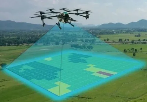
Drone survey at GPSCAD Survey Pvt. Ltd. utilizes advanced UAV technology to capture accurate aerial data for land surveying, mapping, and infrastructure projects. Equipped with high-resolution cameras and GPS systems, drones ensure precise and efficient data collection. This method reduces time, cost, and field risks while improving productivity. The collected data is processed into detailed maps, 3D models, and reports, supporting planning, monitoring, and decision-making across various projects and operational areas.
Topography Survey with Total Station
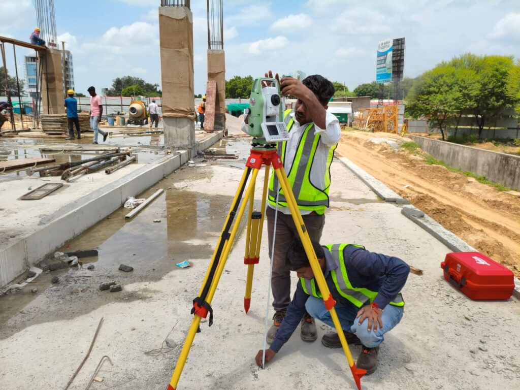
Topography survey using a total station is a precise method to map land features, elevations, and contours. It combines electronic distance measurement and angle calculation to capture accurate field data. The survey identifies natural and man-made features such as boundaries, roads, and structures. Data collected is processed to create detailed maps and contour plans, essential for planning, design, and construction projects, ensuring accuracy, efficiency, and proper site understanding before development.
BOUNDARY SURVEY
We identify and mark exact property boundaries for legal, construction, and ownership purposes. It helps in land purchase, fencing, disputes, and legal verification.
TOPOGRAPHIC SURVEY
We collect detailed information about land features such as levels, slopes, contours, roads, and existing structures. This helps in proper planning and designing of construction and development projects.
We also do survey work for roads and railways. In this, we study land, soil, contour, and topographic.
CONSTRUCTION LAYOUT / SETTING OUT
We transfer design drawings accurately onto the site for correct construction positioning. It ensures buildings, roads, and structures are built in the right location.
AUTOCAD/GIS MAPPING
We create digital maps and databases for land, utilities, and infrastructure. It is useful for planning, management, and smart city development.
CONTOUR SURVEY
We measure land elevation and slopes to create contour maps. It helps in road design, drainage planning, and site development.
DRONE SURVEY
We use drones to capture fast and accurate aerial site data. It is useful for mapping, contouring, and large area surveys.
SOIL TESTING
We analyze soil strength and quality to check suitability for construction. It ensures safe foundation design and strong building structures.
INSTRUMENTS & SOFTWARE
We use modern surveying instruments like Total Station, DGPS, Static GPS, RTK, PPK, and Auto Level for accurate field measurements and leveling work. These instruments help us in boundary surveys, construction layout, and topographic mapping with high precision.
For processing and design work, we use professional software such as AutoCAD, GIS software, and Global Mapper. These tools help in preparing drawings, maps, contour analysis, and land data management.
OBSTACLE LIMITATION SURFACE (OLS)
WGS-84 Coordinate & Elevation Survey
We carry out accurate determination of latitude and longitude in the WGS-84 system along with site elevation (Above Mean Sea Level) using advanced surveying instruments such as DGPS and Total Station, which is essential for AAI NOC approval.
Site / Pre-Feasibility Inspection
We conduct detailed site inspection for surface helipads, rooftop helipads, existing airports, and greenfield airport projects to assess site suitability, surrounding developments, terrain conditions, and aviation safety restrictions, followed by a preliminary feasibility report.
Obstacle & Topographical Survey (OLS Study)
We perform Obstacle Limitation Surface (OLS) surveys to identify all natural and man-made obstacles such as buildings, trees, towers, etc., for surface helipads, rooftop helipads, existing airports, and greenfield airport projects. We also prepare detailed topographical maps, aeronautical charts, and complete survey & cartography drawings required for aviation planning, design, and safety compliance.
Technical Report Preparation
We prepare a detailed technical report including survey data, WGS-84 coordinates, elevation details, obstacle analysis, and recommendations for safe and compliant development as per aviation requirements.
DGPS & Total Station Survey Execution
All surveys are conducted using high-precision DGPS and Total Station equipment to ensure accurate, reliable, and aviation-standard compliant data for all types of airport and helipad related projects.
Professional DGPS Land Survey Services in India for Construction, Engineering & Infrastructure Projects
Delivering Accurate Survey Data for Smarter Planning and Successful Project Execution
Every successful development begins with accurate land information. Whether you’re planning a residential township, commercial complex, industrial facility, highway, airport, solar plant, or government infrastructure project, precise survey data is essential for efficient design, regulatory compliance, and error-free construction.
GPSCAD is a trusted Land Survey Company in India offering comprehensive DGPS Land Survey Services in India for developers, architects, civil engineers, EPC contractors, infrastructure consultants, and government organizations. Using advanced DGPS, Total Station, and digital mapping technologies, we deliver highly accurate survey data that supports every stage of your project—from initial feasibility and planning to engineering design and construction.
Comprehensive DGPS & Topographical Survey Solutions
As an experienced DGPS Land Survey Company, we provide professional surveying services designed to meet the technical requirements of modern engineering and construction projects. Every survey is conducted using calibrated equipment, advanced software, and industry-approved methodologies to ensure reliable, high-precision results.
DGPS Land Survey Services
Our DGPS Land Survey Services provide precise coordinates, elevations, and geospatial data required for land acquisition, engineering design, statutory approvals, boundary verification, and infrastructure planning. High-accuracy DGPS technology minimizes survey errors and provides dependable data for informed decision-making.
Topographical Survey Services for Construction Projects
Our Topographical Survey Services for Construction Projects capture detailed information about ground levels, contours, existing structures, roads, utilities, drainage systems, vegetation, and natural site features. This information enables architects and engineers to prepare optimized designs, reduce construction risks, and improve project efficiency before work begins.
Professional Engineering Survey Services in India
Engineering projects require precise measurements throughout every phase of development. Our Professional Engineering Survey Services in India support residential developments, commercial buildings, industrial facilities, highways, railways, airports, renewable energy projects, and public infrastructure with accurate field data and technical expertise.
Contour Survey and Site Mapping Services
GPSCAD provides Contour Survey and Site Mapping Services to accurately represent variations in ground elevation and terrain conditions. These surveys are widely used for grading plans, earthwork calculations, stormwater management, road design, landscape planning, and large-scale infrastructure development.
Advanced Digital Survey Solutions for Modern Projects
Technology-driven surveying improves project accuracy, minimizes delays, and enhances engineering decisions. Our Digital Land Survey Services combine advanced instruments with experienced survey professionals to deliver dependable site data for projects of every size.
Our survey capabilities include:
- DGPS Survey
- Total Station Survey
- Topographical Survey
- Contour Survey
- Engineering Survey
- Construction Layout Survey
- Boundary Survey
- Elevation Survey
- Utility & GIS Mapping
- Site Mapping
- As-Built Survey
- Digital Terrain Modelling (DTM)
Every survey is verified through rigorous quality control, ensuring accurate deliverables that integrate seamlessly into engineering and architectural workflows.
Trusted Land Survey Company for Infrastructure Projects
GPSCAD is recognized as a reliable Land Survey Company for Infrastructure Projects, delivering accurate survey solutions for complex developments across India. Our experienced team supports:
- Highways & Expressways
- Metro Rail & Railway Projects
- Airports & Aviation Infrastructure
- Industrial Parks & Manufacturing Units
- Smart Cities
- Solar & Renewable Energy Projects
- Transmission Line Corridors
- Warehouses & Logistics Parks
- Commercial & Residential Developments
- Government Infrastructure Projects
With extensive field experience and technical expertise, we help clients reduce project risks, improve planning accuracy, and accelerate execution.
DGPS Survey Services in India Across Multiple Industries
Our DGPS Survey Services in India are trusted by developers, consultants, contractors, and public sector organizations for projects requiring reliable spatial data and engineering precision. Whether your project involves urban development, industrial expansion, transportation infrastructure, or land development, GPSCAD delivers survey solutions tailored to your technical and regulatory requirements.
Why GPSCAD?
Choosing the right survey partner is critical to project success. GPSCAD combines advanced technology, experienced professionals, and proven engineering practices to deliver dependable survey solutions that clients can trust.
Why Clients Choose Us
- Experienced Survey Engineers & GIS Professionals
- Advanced DGPS & Total Station Equipment
- High-Accuracy Digital Survey Solutions
- Comprehensive Technical Reports & CAD Deliverables
- Fast Turnaround with Quality Assurance
- Customized Survey Solutions for Every Project
- Support for Government, Private & Infrastructure Projects
- PAN India Survey Services
- End-to-End Engineering & Survey Consultancy
- Commitment to Accuracy, Compliance & Client Satisfaction
Partner with GPSCAD for Reliable Survey Solutions
If you’re looking for DGPS Land Survey Services in India, a trusted Topographical Survey Consultant, professional Construction Survey Services, or an experienced Land Survey Company in India, GPSCAD is your reliable technical partner.
From Topographical Survey Services for Construction Projects and Professional Engineering Survey Services in India to Contour Survey and Site Mapping Services, Digital Land Survey Services, and specialized surveys for infrastructure developments, we provide accurate, timely, and project-ready solutions that help you build with confidence.
Our services are available in Delhi NCR, Lucknow, Noida / Greater Noida, Jewar Airport, Gurugram, Mumbai / Navi Mumbai, Pune, Bengaluru, Hyderabad, Chennai, Ahmedabad, Kolkata / New Town, Jaipur, Bhopal, Patna, Bhubaneswar, Kochi, Coimbatore, Vijayawada, Nagpur and Indore.
Contact GPSCAD Survey Private Limited today to discuss your project requirements and discover how our advanced surveying expertise can support the successful planning, design, and execution of your next development.
About GPSCAD
GPSCAD Survey Private Limited is a technology-driven surveying and geospatial solutions company established in 2023. We specialize in accurate land surveys, drone mapping, and airport NOC approvals across India.
Useful Links
Major Services
- Land Survey Services
- Airport NOC Services
- Obstacle Limitation Survey Services
Contact Info
📍 261-A, Barra-6, Kanpur, U.P. – 208027
🏢 SRS Tower, Faridabad, Haryana
Copyright © 2026 GPSCAD Survey Pvt. Ltd. All Rights Reserved.